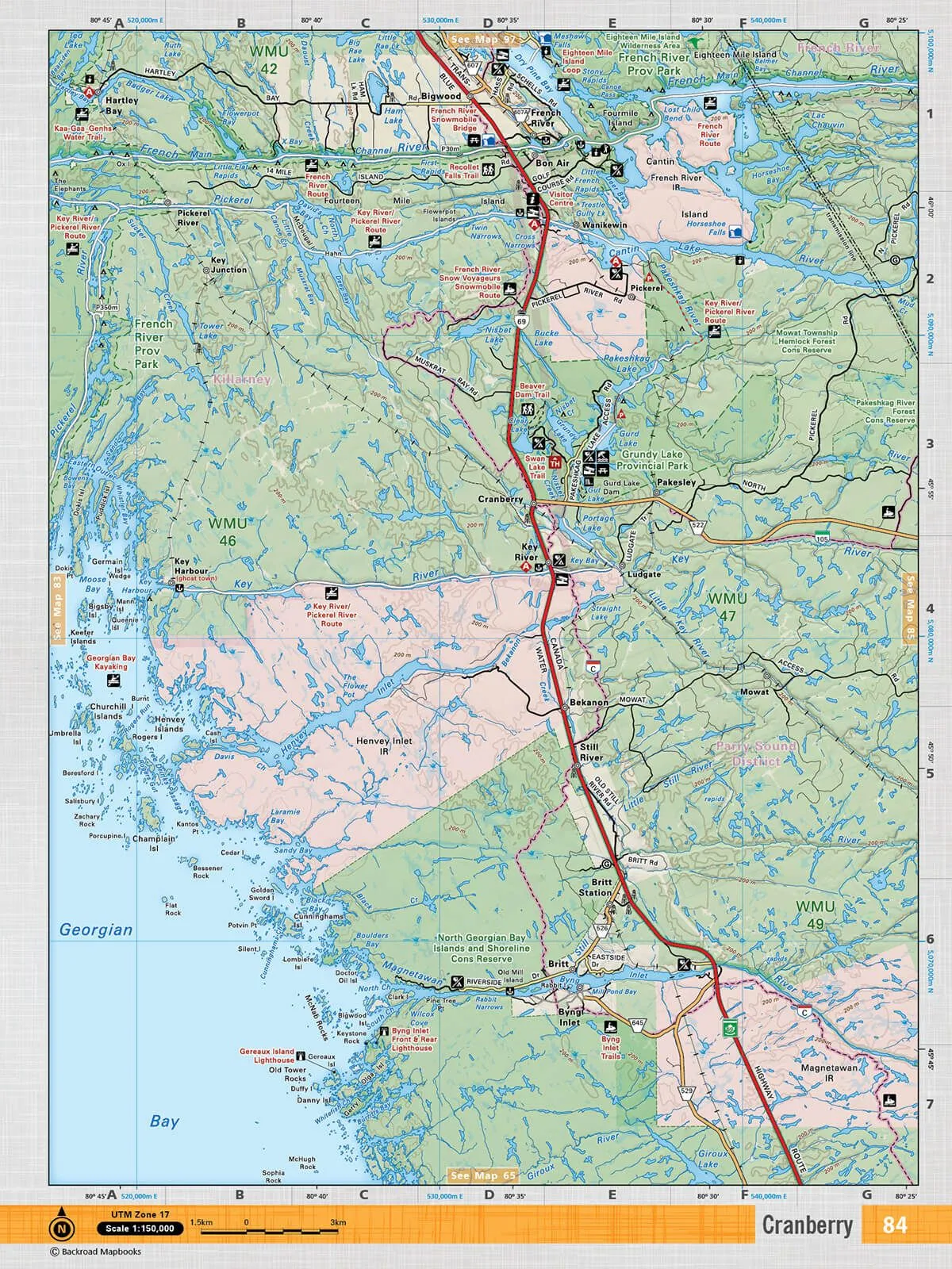
This recreation topographic map for Key River highlights all the logging/resource roads, hunting areas, fishing lakes & streams, campsites, paddling routes for canoeing and kayaking, wildlife viewing areas, multi-use trails for hiking, biking, horseback riding, cross-country skiing and snowshoeing, motorized trails for ATVing and snowmobiling & more. Covering 1,090 km2 (420 mi2), this 1:50,000 scale map measures 29 x 38 km (18 x 24 mi), providing you with more topographic and recreational detail than any other map on the market. New features include enhanced Crown land data, countless new roads and trails and a wealth of recreational Points of Interest. Included on this map are Cranberry, Britt Station, Byng Inlet, Ludgate, French River, Pakesley, Provincial and more!


Cart(0)
 Heavy Duty / Street Disc - NX9-HDSS")


 Heavy Duty /Modified Street - SZ1-HDMM")
